
About Deepwater Concepts
Deepwater Concepts tells you where the fish are most likely to be today, and shows you why. We built it for anglers on the southern NC and northern SC coast who want to spend their fuel on water that's holding fish, not on yesterday's rumor.
How we find fish
Fish biology first. Every species has water it likes: a temperature range, the bait it follows, the structure and depth it holds on, and how that changes through the season. We start from what the science says about the fish.
Then today's water. Every morning we pull the newest satellite water temperature, water color, currents, wind, waves, tides and the moon, and look for the places where conditions line up with that biology: temperature breaks, color edges and structure in the right depth.
Then the people on the water. We lay live reports from our team of captains, plus pier and forum reports, over the water data. A report that matches the water moves a spot up; a report the water doesn't back up gets less weight, so you're not running on hearsay.
The result is an informed estimate, not a promise. Every pick comes with the evidence behind it so you can judge it yourself.
Fishing briefs
Pick your inlet, nearshore or offshore, up to three species and a date. In a minute or two you get the Captain's Daily Brief: the marks worth running to, ranked, with distance and heading from your inlet, the water at each one, the best bite windows from tide and moon, and bait for each species. Save it to your phone for use offshore with no signal, or download the PDF.
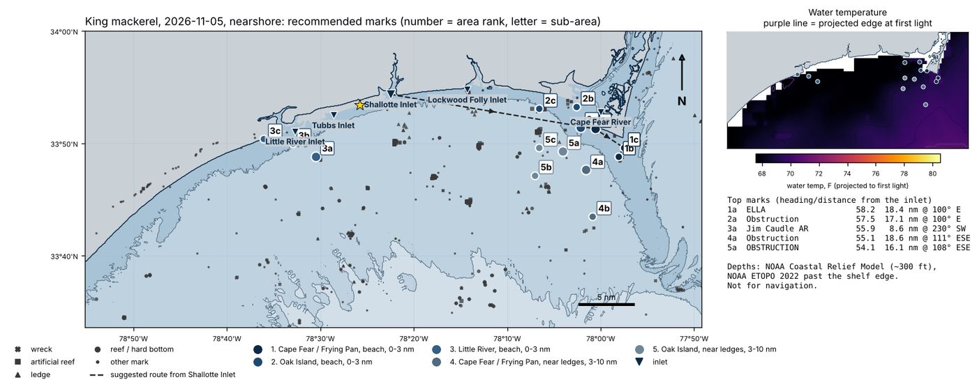
A king mackerel brief: ranked marks, numbered by area, with the run from Shallotte Inlet.
Interactive mapping
The Pro map puts every layer on one live chart: water temperature from several satellites, a blended view that fills in under clouds, 3-day change, break strength, chlorophyll, currents, sea height, wind and waves, plus depth contours and thousands of wrecks, reefs and ledges. Tap anywhere for the readings at that spot.
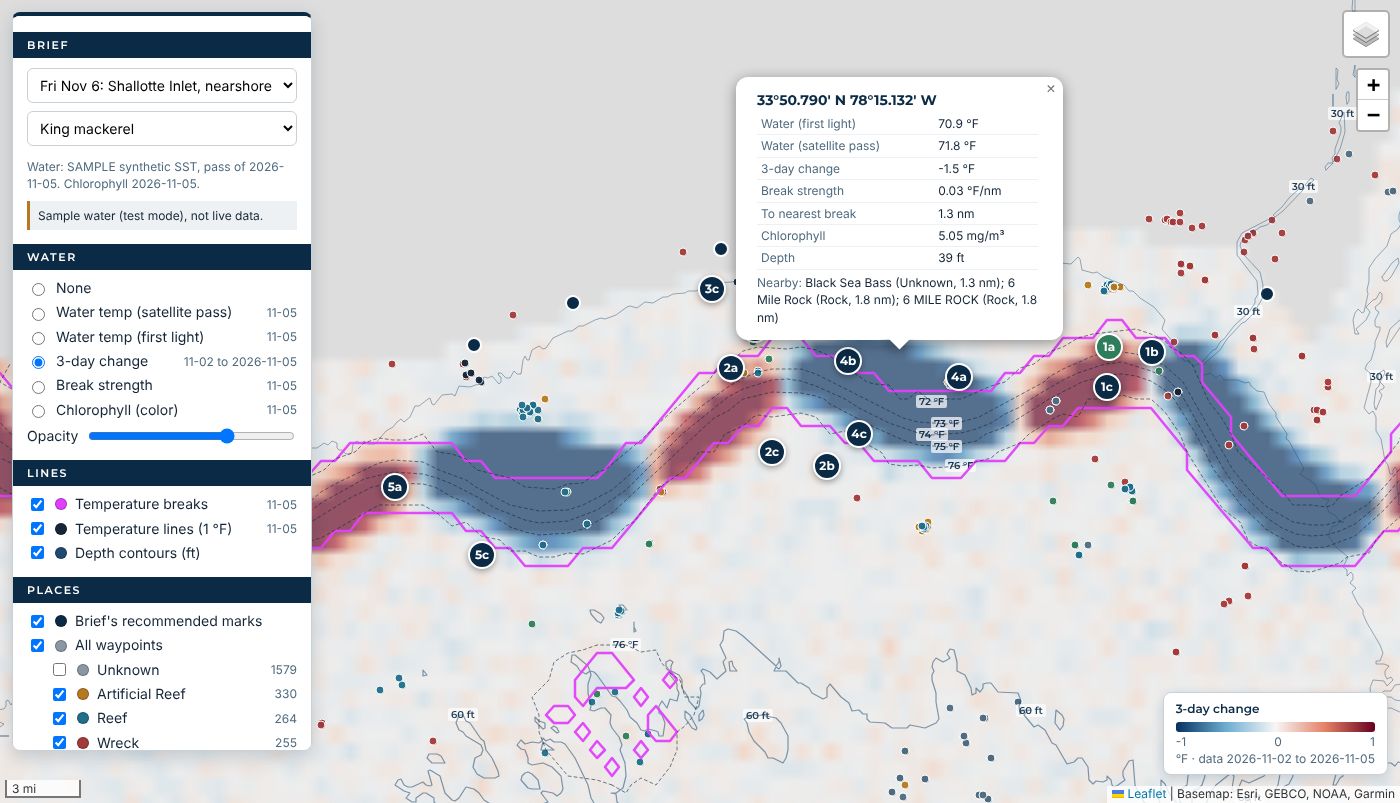
The Pro map with 3-day change, temperature breaks and a brief's marks.
GPS chip cards
Proven waypoints on a card you plug straight into your chartplotter, so the marks from your brief are on your screen before you leave the dock. See the chip cards.
Pricing
Standard
- Unlimited briefs for your home inlet, nearshore and offshore
- Up to 3 species, ranked spots with the reasons
- Tide, moon and bite windows
- PDF download and trip log
Pro
- Everything in Standard, for every inlet
- The interactive Pro map with every data layer
- Describe your day in your own words, and change a brief by asking
- Save briefs offline for no-signal days
Launch pricing. While we're in the test version, accounts are approved by hand.
Our captains
Charter captains on this coast fish with us, send in reports and tell us when a pick is wrong. Their reports feed every brief. Meet the captains and book a charter.
Sign upGet the app